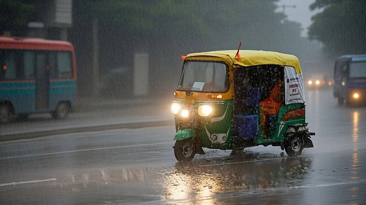
When Indian Meteorological Department issued its alert on October 29, 2025, residents from Kerala to West Bengal didn’t just hear thunder—they felt the earth shift. Cyclone Montha, which made landfall near Kakinada in Andhra Pradesh on the evening of October 28, didn’t just pass through—it left a trail of soaked fields, downed trees, and shivering families. Winds clocked at 90–100 km/h, with gusts pushing 110 km/h, tore across the coast before weakening into a deep depression. Now, the storm’s lingering influence is dumping torrential rain across half the country, triggering flash floods, power outages, and an unexpected plunge in temperatures that’s catching even seasoned meteorologists off guard.
From Coast to Plains: The Storm’s Path
The storm’s death rattle is proving more dangerous than its peak. While Montha’s eye has faded, its moisture-laden remnants are now parked over Telangana and eastern Andhra Pradesh, where rainfall totals have already hit 200 mm in 24 hours. Skymet, a private weather forecaster, warned that coastal stretches from Kerala to Odisha could see 150–250 mm more over the next 24 hours. In West Bengal, the Ganges delta is drowning—districts like Murshidabad and Nadia reported flooded roads by dawn on October 30. Meanwhile, Bihar and Jharkhand are bracing for 100–150 mm of rain through October 31, with local officials shutting schools in Patna and Ranchi.
Temperature Crash: When Rain Brings Frost
Here’s the twist: the same storm that flooded villages is now freezing cities. In Delhi-NCR, maximum temperatures dropped from 32°C to 29°C in just 24 hours—and that’s just the start. IMD predicts a 2–3°C dip in daily highs over the next day, with minimum temperatures falling 2–4°C over the next five days. That’s not just chilly—it’s dangerous for the elderly and those without heating. In Uttar Pradesh, Mirzapur and Varanasi saw overnight lows hit 14°C, the lowest since March. “It’s not just rain,” said Dr. Arvind Mehta, a climatologist at Banaras Hindu University. “This is a cold front riding the storm’s back. People think monsoons end in September. They don’t realize autumn storms can be colder than winter.”
Northwest Surprise: Rain in the Desert
Even Rajasthan, the land of parched dunes, isn’t spared. Eastern districts like Jhunjhunu and Alwar received 50–70 mm of rain on October 30—unheard of this late in the year. “We’ve seen monsoon surges in July, but October? This is a climate anomaly,” said Rajesh Kumar, a farmer in Sikar. His wheat fields, planted just weeks ago, are now under water. Meanwhile, Saurashtra and Kutch in Gujarat are under red alert, with landslides reported near Bhavnagar. The IMD says this is tied to an unusual low-pressure zone forming over the east Arabian Sea—a system that hasn’t formed this late since 2015.
Himalayan Freeze: Snow and Fog in the Hills
Up north, the cold is turning to ice. In Himachal Pradesh and Uttarakhand, light snowfall blanketed Manali and Mussoorie on October 30, the earliest snow of the season in over a decade. In Shimla, fog has reduced visibility to under 50 meters, stranding hundreds of travelers. “We’ve had fog before, but not this thick, this early,” said a dispatcher at the Himachal Road Transport Corporation. “Buses are stuck, and the cold is seeping into homes without proper insulation.” The IMD warns this pattern could last until November 5, with sub-zero temperatures possible in higher altitudes.
What’s Next? The Cold Wave Looms
Montha’s direct impact may fade by November 1, but its shadow won’t. The system has already pulled a cold air mass from Central Asia into northern India. By November 3, a full-blown cold wave is expected to grip Punjab, Haryana, and Delhi, with minimum temperatures potentially dipping below 8°C. That’s when the real crisis begins—power demand spikes, hospitals report spikes in respiratory cases, and farmers lose crops already weakened by excessive rain. The IMD has urged state governments to activate emergency response teams and open shelter centers. “This isn’t just weather,” said senior meteorologist Dr. Priya Nair. “It’s a signal. We’re seeing climate patterns shift. Late-season cyclones, unseasonal snow, rain in deserts—it’s not coincidence. It’s the new normal.”
Background: Why This Storm Is Unusual
Historically, cyclones in the Bay of Bengal peak between May and November, but few survive past mid-October to trigger such widespread inland effects. Montha is only the fifth cyclone to form this late since 2000—and the first since 2018 to cause a temperature crash across five states simultaneously. The 2018 Cyclone Titli, which also hit Andhra Pradesh, led to a 3°C drop in Delhi’s temperature, but nothing on this scale. What’s different this time? Warmer sea surface temperatures in the Bay of Bengal (29.5°C, 1.5°C above average) gave Montha more energy. And with La Niña weakening, the jet stream is behaving erratically, allowing cold air to slip south faster than usual.
Frequently Asked Questions
How long will the heavy rain and storms last?
The most intense rainfall is expected to taper off by November 1, but scattered showers will continue through November 3–5, especially in Telangana, Andhra Pradesh, and Odisha. IMD says the system’s residual moisture will linger for up to 50 hours after landfall, with the highest risk from October 29 to October 31. Coastal areas may still face rough seas and strong winds through November 2.
Why is it getting colder after heavy rain?
The storm pulled in a cold, dry air mass from Central Asia, which is now replacing the warm, humid air over northern India. Rain evaporates and cools the air further—a process called evaporative cooling. This effect is amplified by clear skies returning after the rain, allowing heat to escape rapidly at night. That’s why minimum temperatures are dropping 2–4°C over the next five days, even without snow.
Which areas are at highest risk of flooding?
Low-lying areas along the Ganges delta—especially Murshidabad and Nadia in West Bengal—are most vulnerable. Coastal districts of Andhra Pradesh and Odisha, where drainage systems are already overwhelmed, face repeated flooding. In Bihar, districts like Bhagalpur and Munger have reported breached embankments. Urban centers like Hyderabad and Vijayawada are also struggling with waterlogging due to poor stormwater management.
Are schools and businesses closed?
Yes. Schools in Patna, Varanasi, Hyderabad, and Kolkata have been shut until November 2. In Delhi, private schools are operating remotely. Several state governments have suspended non-essential services. The Indian Railways has canceled over 120 trains across eastern and southern India. Airports in Visakhapatnam and Bhubaneswar have delayed flights due to low visibility and strong winds.
How is this affecting agriculture?
Crops are taking a severe hit. In Telangana and Andhra Pradesh, rice paddies planted in September are now submerged. In Rajasthan, newly sown mustard and wheat are rotting in waterlogged fields. Farmers in Uttar Pradesh report a 30–40% yield loss in winter crops. The government has announced compensation packages for affected farmers in six states, but distribution delays are expected. Experts warn this could push food prices up by 5–7% in the coming weeks.
What should people do to stay safe?
Stay indoors during heavy rain and lightning. Avoid low-lying areas and flooded roads—just 15 cm of moving water can sweep away a car. Keep emergency kits ready: flashlight, batteries, dry clothes, and medicines. Use blankets and warm layers indoors—electric heaters should be used with caution due to power surges. Check on elderly neighbors. And don’t ignore fog: drive slowly, use fog lights, and avoid unnecessary travel in northern plains.